Mt Meru

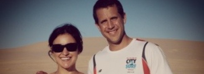
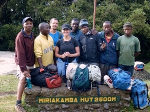
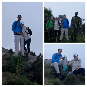
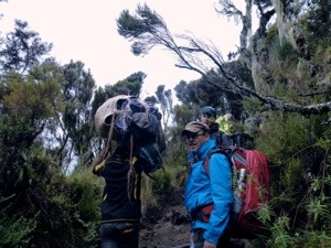
Our guide – DUMA (which means Cheetah in Swahili) – picked us up at the hotel about 9AM. It was the first time we negotiated with our guide to pick us up at a reasonable hour (rather than 5AM). When he arrived, the van was already full with 6 people not including us. It wasn’t until we arrived did we realize those people were coming along to support us. In total, we had our guide (Duma), a cook, a driver, and three others to help carry our items (bags, food, sleeping bags, etc.) as can be seen in the pictures below.

20140214-144902.jpg

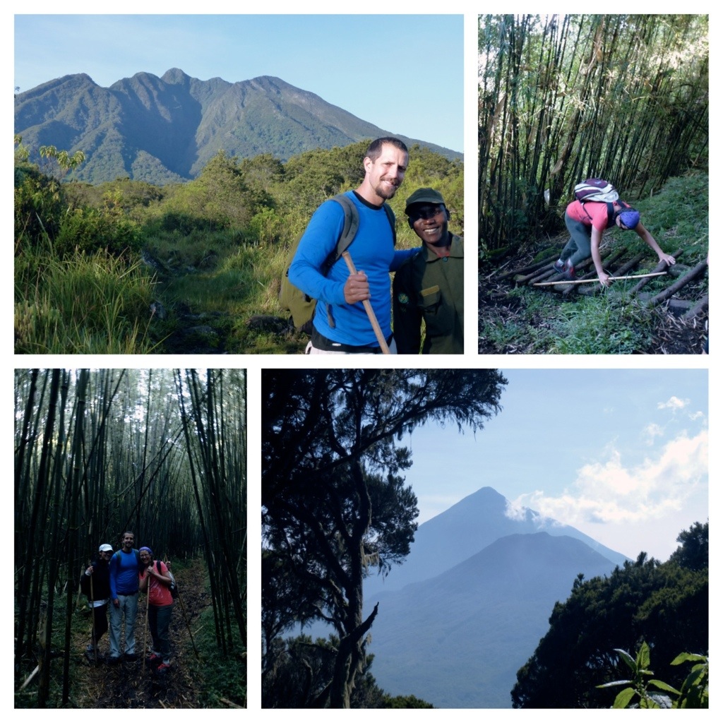
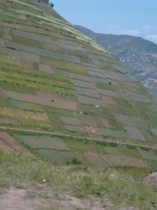
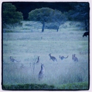
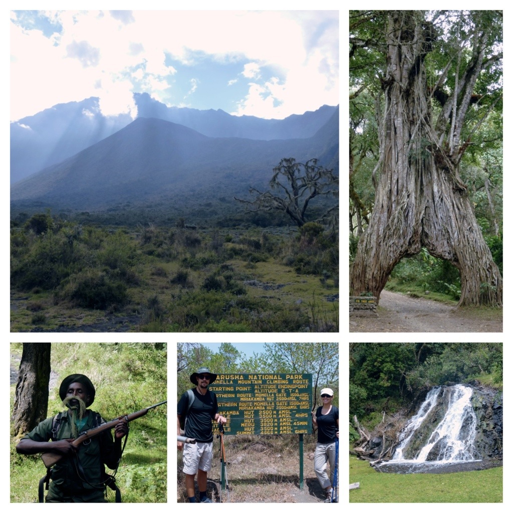
The first day of the hike was 14 KM which took us about 5 hours. We would’ve gone faster considering the 14 KM was basically a walking safari, but the armed ranger asked us to kindly slow down since we were hiking with other groups (in total 10 other people). We were able to see buffalo, zebra, giraffe, colobus monkey, blue monkey, bush buck, dik dik, and many others. The surrounding area was beautiful; dense forest trees, green vegetation, mountains, etc.

20140214-144210.jpg

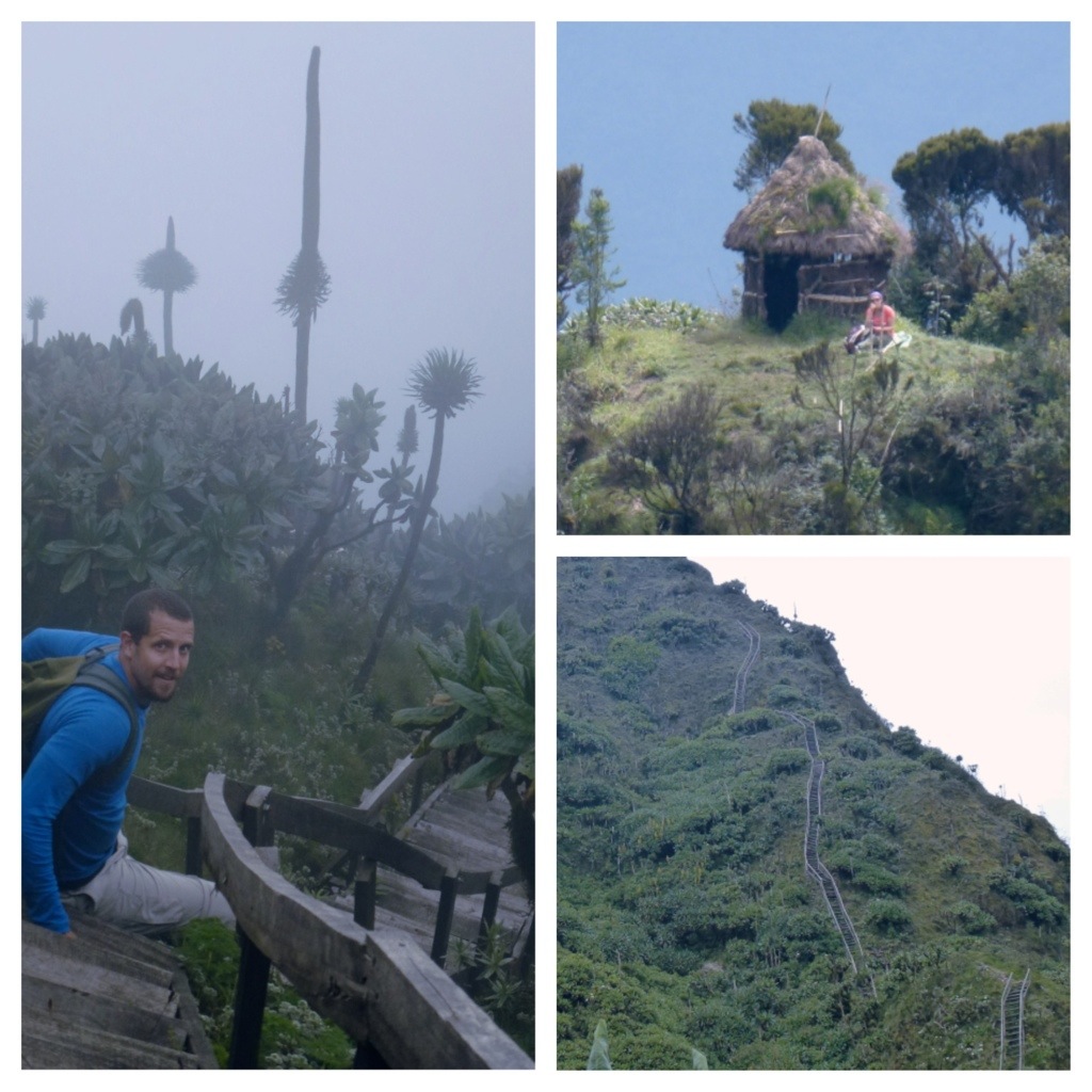
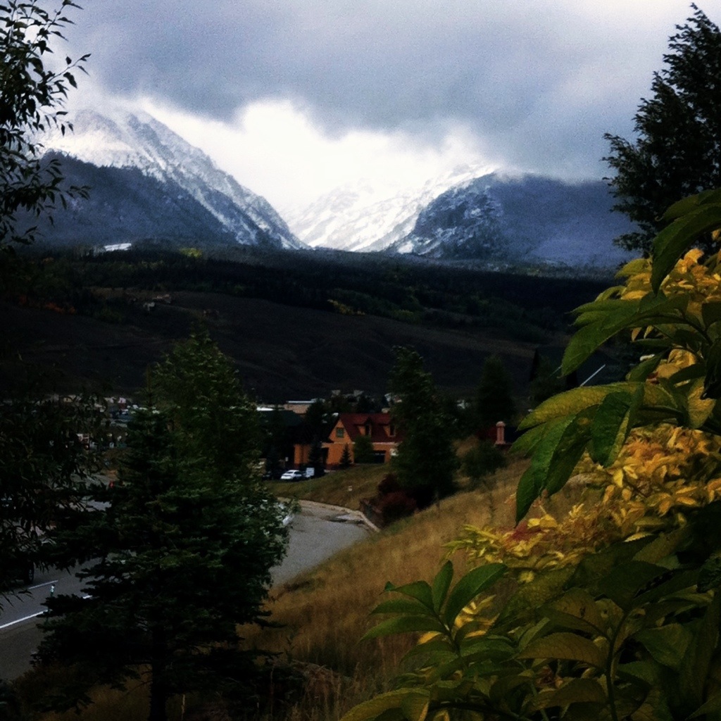
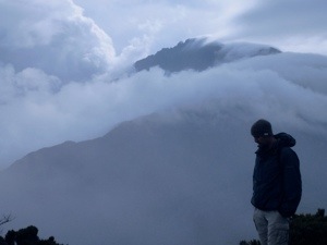
Once we got to around 7,000 feet the vegetation became a bit less dense and green and we could now see the summit. Unfortunately, Kilimanjaro was blocked by clouds and we weren’t able to get a good picture (later – after several days of hiking – we were only able to catch a 5-10 second glimpse of the mountain).

20140214-144812.jpg

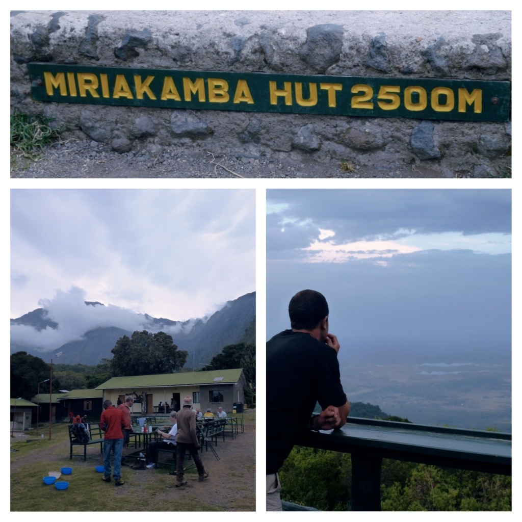
The first camp was pretty impressive; over 100 guests could stay with 4 bunk-beds in each room. It also had bathrooms, a kitchen and dining hall. The ranger had discussed that he’d get us the best room in the hut… Later, we realized he was only kidding. The camp was at about 7,500 feet.

When we arrived we had time to “wash off” (no shower or hot running water) with a wash cloth, then hung out with Duma. The crew then made a really nice meal, soup, tilapia (a very popular dish in Uganda), rice and veggies.

20140214-144723.jpg

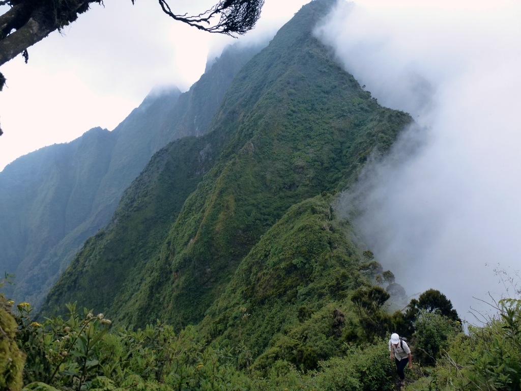
After breakfast, we began the trek to camp 2 – a 7KM from 7,500 ft to 10,500 ft which was much steeper than the first hike (same elevation gain but half the distance). We were going along the ridge to the saddle huts, at the saddle between Meru and Little Meru. Unfortunately the sky did not clear up, in fact we just kept hiking further and further into the clouds. Luckily, there was no hard rain like Mt Sabyinyo but the temperature was dropping quickly!

20140214-144742.jpg

20140214-144749.jpg

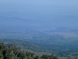
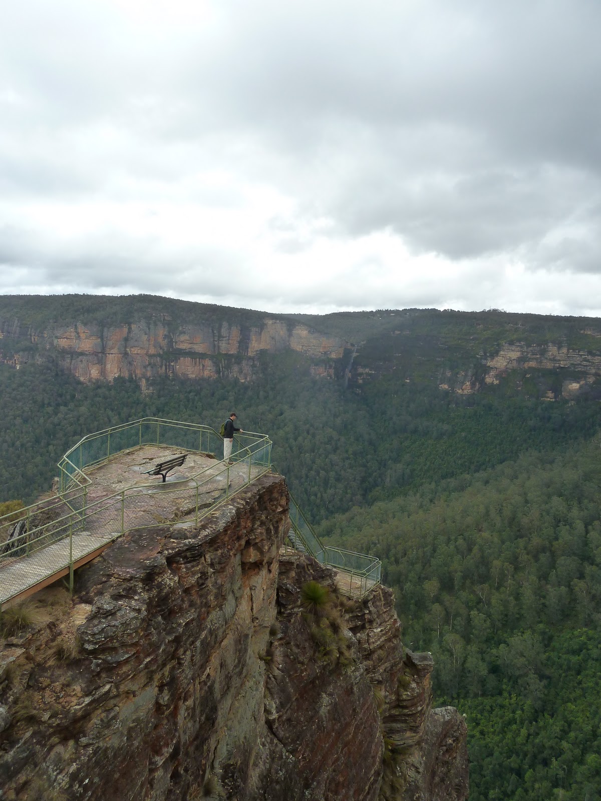
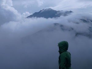
We made it to the Saddle huts around noon for lunch and I was convinced we could’ve continued onward for the pure reason of staying warm. We were in desperate need of hot water to wash up (as you can see by the picture of me below — attempting to ‘wash up’) and for tea and coffee. As the porters and Duma could tell you, I quickly learned how to say “Warm Water, Please” in Swahili after this hike… “MAJI MOTO TAFADHALI”… Most of the huts had the windows open AND some windows were even broken!! No wonder it was freezing. After lunch, we made our way with a lovely group of Austrians to Little Meru where we were hoping to rise above the clouds to see Kibo (what the locals refer to Mt Kilimanjaro) and Mt Meru. The clouds parted once we made it to the top and we were finally able to see views of the summit.

20140214-162417.jpg

During dinner we discussed our plan for the next day – a wake up call at 2 AM (7KM hike with 3,000 ft of elevation gain) and summit the mountain by sunrise. Due to the cold weather, we tried to snuggle up in the sleeping bags and be in bed by 8:30 PM but failed to get any real sleep. Even worse, by 9 PM we could hear rain beating down on the hut, making it an unlikely departure of 2 AM.

Still at 1:30 AM, the rain was pouring! Our guides informed us that we would wait it out and try again at 6 AM. It was still drizzling at 6 AM, but Duma came in and said “Pack your bags, we are leaving in 10 minutes!” I could not believe he came to this conclusion, considering other groups were contemplating leaving the hut at all. We had a light breakfast (1 hard-boiled egg each and coffee) and hit the trail by 6:50 AM – the first (and at that point, the only) group out the door.

20140214-162343.jpg

20140214-162449.jpg

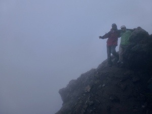
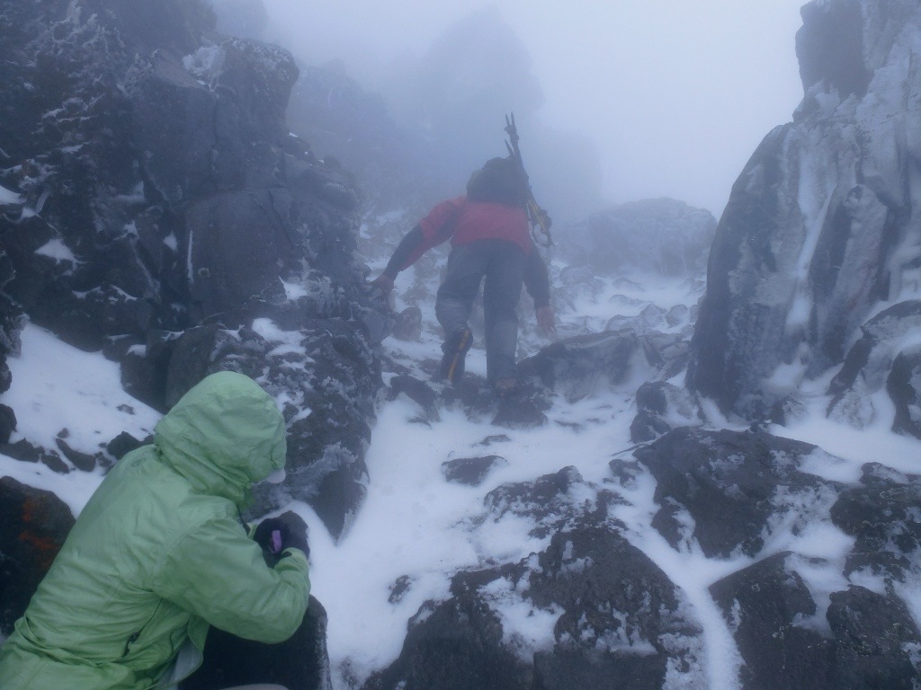
While it wasn’t raining, the clouds and mist were very thick; low visibility and very high winds. Soon we were soaked from all the mist and it was starting to get even more cold. At times the wind was blowing 50-70 mph and towards the top it started to snow. I took a video of Rob and Duma near the top — check it out here: https://www.youtube.com/watch?v=IIrKQkNDJKo&feature=youtu.be.

20140214-162409.jpg

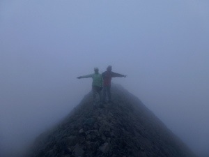
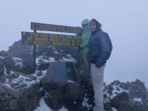
There was a point where I couldn’t feel my pinky fingers at all and had contemplated turning around due to frostbite. We even told Duma we were thinking of turning back and he looked at us like we were crazy, saying we were only 20 minutes from the top. We trudged on and finally made it; ~15,000 feet – The tallest mountain we have ever climbed and, considering the weather conditions, the hardest mountain we have ever done. We even got a few views of the top of Kibo as the clouds blew by!

20140214-162401.jpg

On the way down we passed the other three groups and gave them words of encouragement (and even snagged gloves off the Austrians – which saved my life!). We were happy to hear each group made it. In total, the summit trip took us 6 hours for the 14 km round trip – the fastest group of the day. Even better, Duma said this was the hardest Mt Meru climb he had ever done in the 20 years he has been climbing it!!!

20140214-162424.jpg

The way down was much more pleasant and we enjoyed conversations with the Austrians and Duma. We learned a lot more about the country of Tanzania and Austria (apparently a MUST-SEE — so it could be next on the list of places in the world to visit!!). We couldn’t have asked for a better guide – Duma was amazing and full of knowledge. We would highly recommend him if you ever make the trip to Tanzania and wish to climb Mt Meru or Mt Kilimanjaro.

Until next time, Asante na Kwa heri!

20140214-162438.jpg

Mt Sabyinyo

There are three main volcanoes near the town of Kisoro each between 10,000-13,000 feet high and the volcano that appealed to us the most was Mt Sabyinyo (whose summit marked the border between Uganda, Rwanda and the Congo). Mt Sabyinyo translates to mean “old mans teeth” and was given this name because the mountain had three separate jagged peaks which could look like an old man missing some teeth. Essentially, at the top we could be in three countries at once as well as say we’ve been in the Congo and Rwanda! Despite the 8-10 hour round trip and 4,000 ft elevation gain, we were convinced. This also meant another 5AM wake up call.

20140214-142921.jpg

The roads up to the start of the hike were unpaved and extremely rocky, making a 10-minute drive turn into over an hour. By the time we arrived, we were ready to get started! We had two tour guides – Brian and Ellie (our armed security guard). and hit the trail at 7:37 am, knowing we were in for a long hike. The first hour and a half was fairly easy, a slight incline as we made our way to the base of the volcano. The annoying part was making our way through some very swampy areas. The deep muddy water was unavoidable and we had to slowly pick our way through the swamp. The soft ground made it easy to spot elephant and buffalo tracks which were all over the place. Fortunately, Ellie didn’t have to use his gun as we only heard the animals but did not see any. Below are pictures of our first glimpse of the Congo and Rwanda.

20140214-142943.jpg

20140214-142951.jpg

The lower part of the hike had some amazing dense bamboo forests. Once at the base of the volcano we were told things were about to get more difficult and we could see why. The trail now was going pretty much straight up, along a ridge that will take us to the first peak. It was about an hour and a half to the summit of the first peak and we probably gained 2,000 feet in elevation… At the top we could see the next two summits and could see the ladders that you had to climb to reach peak three (see pictures below). Along the way we had already used some of these ladders which were built out of sticks to help with steep sections. Peak 3 was pretty much all ladders since we had to go straight up to reach the top. This part was very scary for both of us.

20140214-142933.jpg

20140214-143011.jpg

While we were never that high off the ground, the ladders were built on a very narrow ridge with 1,000 foot drop offs on either side. To make things worse a few of the ladder steps were loose and would move just a little bit. Very unnerving considering the height. We made it to the top of peak 3 with our guide Brian at around 11:50 pm. My mom stayed back at Peak 1, she was very tired and was not up for the ladders and wisely stayed back with Ellie. It was one of the scariest things we have ever done.

20140214-143004.jpg

At the top, we made sure to spend some time in each country and even had lunch in the Congo (hey! Now we can say we have been to Rwanda and the DRC!). We had great views looking out towards Rwanda but clouds had rolled in blocking our views of the Congo. Brian thought it was best that we start the hike down given the cloud coverage and his prediction turned out to be true. For 2 hours, we were pummeled by one of the biggest downpours I have ever seen. Soon the trail turned into a river and every inch of us was soaked. We even had hail, painful enough that we had to keep any bare skin protected. Unfortunately, this slowed our pace down and we didn’t make it back to the car until 4:10 pm, 8.5 hours in total and soaking wet. Still, it was one of the most rewarding mountains we’ve climbed. It was physically demanding, 8.5 hours, 4,000 ft elevation gain, and submitted 5 peaks in total. As I said, climbing those ladders was one of the scariest things we’ve done but it was worth it to see the amazing views and check two more countries off the list. We also had a great time with our guides, Brian and Ellie. Two very nice guys which really made the trip more enjoyable. We had never been more excited for a warm shower and decided not to climb another volcano the next day. Especially with our plan to watch the Super Bowl at 2:30 am which is all I will say about the Super Bowl. The next day we were exhausted and enjoyed a lovely afternoon on the lake — where our guides were canoeing and we were relaxing!

20140214-143019.jpg

We loved Kisoro – wonderful little town in Uganda.

At this stage of our trip, 5AM wake up calls were becoming the norm. Today, after only two hours spent in the car, we arrived at Biwindi National Park for the gorilla trek. The drive to the visitor center was rough but took us through spectacular scenery (very similar to the road that took us to Kisoro); very steep drop offs, big mountains and lush green rainforest. It was amazing to see how much of the mountainside the locals are able to farm. Even on the steepest slopes, they have crops planted to the top. This area also gets very misty in the morning so we can see where the term “gorillas in the mist” came from.

20140214-143254.jpg

Neither of us really knew what to expect for the gorilla trek. All what we were told was (1) it could take up to 8 hours to find them and (2) to bring a rain jacket. I (Rob) thought we would be in a big group and only see them from a long distance, but what ended up happening was the 30+ trekkers were broken up into 4 groups. Each group had a guide and a security guard with an AK47. The reason for the gun was to protect us from other animals, including elephants and buffalo which are known to charge at times. Even the gorillas could be unpredictable. It turns out each group hikes to their own family of gorillas (which is about 10 gorillas per family and up to 20 gorillas). Each family has 2-3 people following them on a daily basis to ensure the trekkers are able to see them.

20140204-133057.jpg

20140204-133036.jpg

So our group of 10 (including 2 guides) set off to go find our family of gorillas (interestingly, we found out later how many locals know the gorilla families and asked us which family we were following). Most of the hike was along a pretty nice trail through the rainforest. After about an hour our guide received word of where exactly the gorilla were located. This meant bush-whacking time. Our guides used big knife to start blazing a trail through the rainforest towards the location of the gorillas as we slowly followed behind, slipping and sliding down a steep embankment. Twenty minutes later, we saw our first silver back (a.k.a. THE KING OF THE JUNGLE). I couldn’t believe how close we could get!!

We got some amazing pictures and had over an hour with the wild gorillas. Even better, our guides said we were lucky to have such good views and were able to get so close. An amazing experience to say the least.

20140204-132353.jpg

20140204-132313.jpg

I found all this Gorilla information just fascinating. We learned a vast array of info from Gorilla Tours including:
– About 98% of the Gorilla DNA is equal to man
– The word “Gorilla” means “a tribe of hairy women” or “hairy person” (in Greek)
– Four gorilla species exist today: (1) Western lowland (2) Cross river (3) Eastern lowland (4) Virunga and (5) Bwindi (we saw the Bwindi Gorillas where there are ~400 animals)
– Groups are built around one dominant silverback and groups consist of an average of 12 animals and up to 40

Male Gorillas:
– Males are considered adults between 12 and 14 or at the point at which their silverback has matured (i.e. gray air on their backs)
– Sweat glands are located in the armpits and in times of stress, the males have a strong body odor
– The dominate male decides when the group should eat, sleep or rest and when to break up. He also has exclusive rights on mating
– If a silverback takes over the leadership of a group, it may take several months before the other group members accept his as the dominant silverback
– All gorillas will beat their chests when greatly excited; however the chest-beating of males is most used to impress, intimidate and test the strength of the opponent
– Male life expectancy is 26 years old

20140204-132334.jpg

Female Gorillas:
– Females are considered adults at the age of 8 and don’t have children until 10
– At birth, males and females weight about 2 lbs and females breast feed their offspring for the first 36-months of life
– A female will be fertile for an average of 14 years, producing 5 young in her lifetime
– During the first 4-5 months of the young’s life, there is 100% contact with the mother. It’s not until 1 year that the young will increase its independence
– Females will usually change groups a couple of times during their lifetime and the dominate silverback of the group may try to prevent this from happening.
– The bond between the mother and daughter is close (unlike other females within a group) and the urge to be with a mate who offers her protection is deeply rooted
– Older females in terms of status directly stand below the dominant silverback
– Female life expectancy is between 25 and 35 years old

20140204-132342.jpg

Lifestyle:
– Gorillas benefit from feeling comfortable and safe within the group
– Physical contact between the different group members is very important for their survival. Some research has shown that those who are kicked out of their group can become depressed and as a result they stop eating and could get sick and die
Sleep:
– Lighter females will typically sleep in the trees while the males will sleep on the ground
Food:
– Primarily herbivores but also eat fruit, insects and dead wood (due to the sodium content). This includes bamboo shoots and will also depend on the seasons (i.e. the Bwindi gorilla east more fruit since it’s more readily available than the Virunge gorilla)
– Due to their large and long intestines, they need to eat large amounts of food per day (upwards of 20kg per day!)
Communication:
– Gorillas use visual (body and facial expressions) and vocal communication
– Vocal communication consist of 25 different sounds including roaring, hooting, giggling, barking and growling

Knysna, South Africa

20140123-173224.jpg

The main task for the day was making the 5.5 hour journey to Knysna on the Garden Route. After checking out early we decided to swing by the famous botanic garden, Kristenbosch (see pictures above). It was pretty spectacular and lived up to the hype.  It’s located on the slope of Table Mountain and more plant species than I could begin to imagine – certainly a worthwhile stop before the drive. Most of the drive was over pretty dry rolling hills, saw a few ostrich along the way but not much else out there. Once we got back on the coast we stopped at Mossel Bay – not the best town and we were hoping Knysna wasn’t similar!

20140123-173245.jpg

Luckily, Knysna was nothing like Mossel Bay.  Once we passed Mossel Bay the vegetation changed (big trees and much greener) you could now see why it was called the Garden Route.  Knysna is located on a massive lagoon, surrounded by mountains and a narrow gap called the heads where the ocean opened up.  There were also a few islands on the lagoon where houses and restaurants were built. After checking in to our apartment where we spent the next 4 nights, we made our way to a recommendation for dinner on one of the islands.  Another amazing location for dinner, right on the water in time for sunset.

20140127-165953.jpg

20140123-173320.jpg

20140123-173329.jpg

20140123-173336.jpg

After only catching a glimpse of the town the evening before, we decided to spend the day in Knysna. We drove out to both the East and West heads.  There were tons of jelly fish that washed up on the beach as well as potential shark sightings – this made for a quick swim in the shallow water!  Still, the beach was stunning.  There was another spectacular sunset that evening and we couldn’t stop taking pictures because it kept getting better and better.  It’s probably one of the best I have ever seen (and didn’t think I would say that so soon after the Table Mountain sunset)!

20140123-173347.jpg

On our list of places to see on the garden route was Plettenberg Bay, only 20 minutes up the road from Knysna.  We were given a recommendation from the apartment owner to hike around Robberg Point. Robberg is the Afrikaans word for seal and we soon fount out why it was called Seal Point.  The loop took us up and down on a very picturesque peninsula and after about 30 minutes of walking we saw a massive seal colony (no wonder sharks like it around here).  There must have been thousands of them and even though we were way up above we could hear and smell them.  Again, amazing views.

20140123-174728.jpg

The owner of the Bed and Breakfast we stayed at was so nice! In fact, after 20 minutes of chitchatting he decided to join Rob on the golf course (30 minutes outside of Knysna). According to Rob, it was the “best golf course I’ve ever played on”.. I’ll take his word for it because the views were absolutely stunning. The owner also set me up with a day at the spa — an easy offer to accept! It was needed after 5-6 days of non-stop trekking.

20140127-165929.jpg

On our way towards the Cape Town International Airport, we were able to spend a few evenings in wine country – in a small town called Stellenbosch. Bed and Breakfasts seem to be fairly popular and it’s one of our favorite ways to travel – this place was situated in the heart of wine country with some amazing views. Why not enjoy a few bottles of wine on our balcony (pic taken below)?? After another recommendation from our friend Innes, we spent the evening at Moyo – a very traditional African restaurant where the staff paints your faces upon arriving, perform African dances, and serve you like the king! And the traditional African food was just as good.

20140123-175309.jpg

20140127-165938.jpg

20140127-170009.jpg

Organic Getaway

Before leaving for the states, Rob took me out to celebrate my birthday at a very nice restaurant in Surry Hills. He surprised me with a weekend away in the Barrington Tops National Park – about 4 hours north of Sydney. Best part of it? The place we stayed was an all organic, 100% sustainable farm with very limited access to TV and wifi! It was our “vacation after our vacation” to the states and it was certainly needed. We hiked around, met the locals, drove to the highest point in Australia (1600m), ate deliciously cooked food, and slept (a ton). It was a perfect gift!

20131116-214906.jpg

Success!

We had such a fabulous time during our 2 weeks in the states. Thank you to all of our family and friends for making our trip so wonderful!

20131114-200734.jpg

It was a busy few weeks with an engagement party, 2 stunning mountain weddings, a Broncos game (Rob’s first ever regular season NFL game), a Rockies game (Todd Helton’s last home game)…

20131116-154222.jpg

…plenty of day hikes in the mountains, walks and runs, golfing, story telling, Tim Tam Slams…

20131114-200743.jpg

20131114-200720.jpg

…birthday celebrations, brekky/lunch/dinner/coffee catch ups with friends, wedding venue ‘shopping’, shopping in general, alcoholic beverages, BBQs…

20131116-161954.jpg

20131116-154206.jpg

…minding the kids, awkward O’Keefe family photos (see below)… the list doesn’t stop…. But it was all worth it! All said and done, we stayed at 8 different places over the course of 16 days! A special thanks to The Ralph’s, Al, Jeremy, Maria, Kristen and The Schneider’s for giving us a pillow to sleep on during our time at home.

20131116-160921.jpg

And thank you for those who made the trek to Ft Collins for our engagement party – during some of the worst flooding Colorado has seen in years.  Luckily, the skies cleared and it turned out to be a lovely afternoon at The Ralph’s in FoCO!!  Thanks for hosting, Mom/Mum/Maureen and Dad!!!

20131116-194651.jpg

Sam and Vaneesa

20131113-201125.jpg

We were lucky enough that two of my best friends had their weddings back to back weekends so we were able to make both of them. Another beautiful mountain wedding, this one in Vail at the Arabella Hotel. Sam had two roles in this wedding; groom and wedding planner and he nailed both of them.

20131113-201141.jpg

20131113-201150.jpg

20131113-201159.jpg

20131113-201208.jpg

Lots more babies around since last time we were home, that’s for sure!
Great to meet Luke and Lila for the first time.. Another awesome weekend! Between the weddings and get togethers, we were able to see so many good friends. Reminded us that it is time to get back home!

20131113-201216.jpg

The Schneider’s Wedding

20131102-174509.jpg

Adam Schneider and Christie Hughes had their wedding at the amazing Park Hyatt Beaver Creek Resort and Spa. The entire weekend was spectacular; the Colorado fall colors were brilliant, the September weather was perfect and the people made the event that much more special.

20131103-163347.jpg

20131103-163413.jpg

They really went all out for this wedding. It was one of the larger weddings I have been to with over 250 guests including my mom and brother. The best part of the wedding was seeing all these guys who I haven’t seen in years. Although could have gone without seeing Birkel…

20131102-144434.jpg

20131103-163442.jpg

This was the first wedding I’ve been to that had a late night snack. Schneider and Christie were long gone before the snacks because they snuck out early.

20131107-183329.jpg

20131103-163528.jpg

20131113-184724.jpg

They eventually kicked us out of the reception but not before we got a
picture of the “last group sanding”. Kevin and Jackie Schneider were the MVPs of the last group. After a long night of dancing, it was time to lay down…

20131107-183027.jpg

20131107-183035.jpg

The Rehrig’s

20131014-141815.jpg

We were SO excited to have Kyle and Jules come visit us!! They had quite the itinerary too – flying directly to Sydney to spend time with us for a week (with a side trip to the Hunter region over a long weekend), then spent several days on the southern island of New Zealand, flew back to Sydney for a few nights (repacked for swim suit weather), then up to the Whit Sunday Islands to snorkel and check out the Great Barrier Reef and finally back to Sydney for one last night before taking the 14-hour flight to LAX! PHEW! They probably experienced all four seasons over the course of 3 weeks too (with the worst being on the islands during their snorkel trip, unfortunately).

20131014-141825.jpg

20130825-153436.jpg

We were able to find the best accommodation in the Hunter Valley – wine region – since we’ve moved out here (and it only took us 10 tries to figure it out!). As can be seen in the picture above, there were 3 houses on the property including a tennis court, a swimming pool, the owners’ house and hundreds of acres of grape vines. And despite the “hassle” 20-minute drive outside the main part of Hunter Valley, we had several acres of cows, kangaroos, birds, vineyards and millions of billions of stars to gaze at from our own porch!

Even more important, we had ample room to throw around the (American) football in the yard. We also received a case of wine upon arrival, along with a wine tasting and a brief history lesson from the owners. Not sure how we could’ve beat that!!

20131014-141333.jpg

20131014-141323.jpg

20131014-141309.jpg

I raised my hand for the ‘Designated Driver’ role so Rob, Jules and Kyle could have a true experience of Hunter Valley wine tasting. The day did little to disappoint with over 5 stops at the local wineries. Afterwards, we spent the evening playing charades.. which made for an extremely interesting and exciting evening (Rob & Linds vs Kyle & Jules). (Picture: Jules is trying to show Kyle what he should have done when trying to imitate a character). It was great fun!

20131016-185334.jpg

20131016-191551.jpg

20131016-191600.jpg

One of the best parts of their holiday was during my attempt to explain how people in Australia call out to kangaroos. When Kyle and Jules arrived, I told them the best way to see a kangaroo is to call out and chant, “Swish, swish, swish, swish”. During our stay in Hunter Valley we were walking around the property and we were able to get them to start chanting with Rob & me..

They were SOLD!!!

But it was short lived.. Jules quickly caught on and asked if we were teasing them. It’s hard to hear in this video, but still pretty hilarious: http://www.youtube.com/watch?v=01pPxwj7Dd8&feature=youtu.be.

20131016-191635.jpg

20131019-131721.jpg

Blue Mountains

The Blue Mountains are about 2 hours west of Sydney. We stayed at a bed and breakfast (minus the breakfast) in a town called Katoomba.

Lots of cliffs and waterfalls

This trail was for “experienced walkers only”

Took awhile to find a place to set the camera and set the automatic timer.

These are the Three Sisters, one of the biggest attractions at the Blue Mountains

Pulpit Rock

North Head

 Not a bad way to begin a sunny, winter day in Sydney. Rob and I grabbed a ‘hearty’ hike just south of Manly Beach.  We posed for a quick shot at Shelly Beach, a beach full of sea shells and sand, then worked our way out to North Head.
 View of downtown Sydney from North Head
 Here is a view of South Head.
 North Head and South Head create the only entrance into Sydney harbour. In the 1930s, North Head, South Head and Middle Head were used to set up military posts in case of attack. (http://www.harbourtrust.gov.au/visit-our-sites/north-head-sanctuary/history/index.html).

We did some whale watching along our hike and were lucky enough to see a few! According to the Sydney Wildlife website: “Humpback Whales are most likely to be seen between the months of June (Winter) and October (Spring).

They are known to swim very close shore where they will swim into large bays and Harbour areas in order to rest and gain protection during times of rough seas. In Autumn, as the water temperatures fall resulting in ice forming on the surface of the ocean, the Whales will begin their northward migrations up the East and West Coasts of Australia. This mass migration takes them to more temperate, sub tropical waters where Whales will mate, and the female Whales will give birth to calves. The Whales will then begin the migrations back south down the East and West Coasts of Australia at the end of spring.


By summer, the whales are seen in the freezing waters of Antarctica where they feed on the enormous quantities of Krill (a prawn like species) that makes up their enormous diets.

We did an entire loop and ended up back at Manly Beach.