|
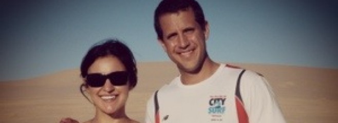
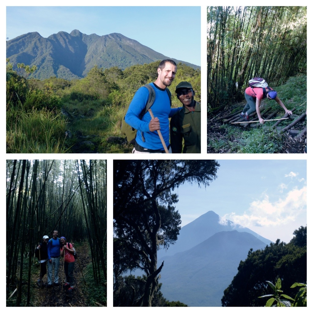
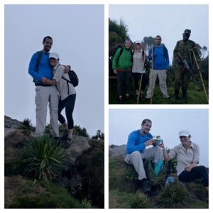
There are three main volcanoes near the town of Kisoro each between 10,000-13,000 feet high and the volcano that appealed to us the most was Mt Sabyinyo (whose summit marked the border between Uganda, Rwanda and the Congo). Mt Sabyinyo translates to mean “old mans teeth” and was given this name because the mountain had three separate jagged peaks which could look like an old man missing some teeth. Essentially, at the top we could be in three countries at once as well as say we’ve been in the Congo and Rwanda! Despite the 8-10 hour round trip and 4,000 ft elevation gain, we were convinced. This also meant another 5AM wake up call. |
||||||||||||
|
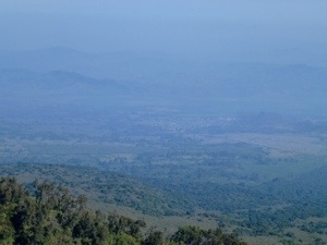
The roads up to the start of the hike were unpaved and extremely rocky, making a 10-minute drive turn into over an hour. By the time we arrived, we were ready to get started! We had two tour guides – Brian and Ellie (our armed security guard). and hit the trail at 7:37 am, knowing we were in for a long hike. The first hour and a half was fairly easy, a slight incline as we made our way to the base of the volcano. The annoying part was making our way through some very swampy areas. The deep muddy water was unavoidable and we had to slowly pick our way through the swamp. The soft ground made it easy to spot elephant and buffalo tracks which were all over the place. Fortunately, Ellie didn’t have to use his gun as we only heard the animals but did not see any. Below are pictures of our first glimpse of the Congo and Rwanda. |
|||||||||||
|
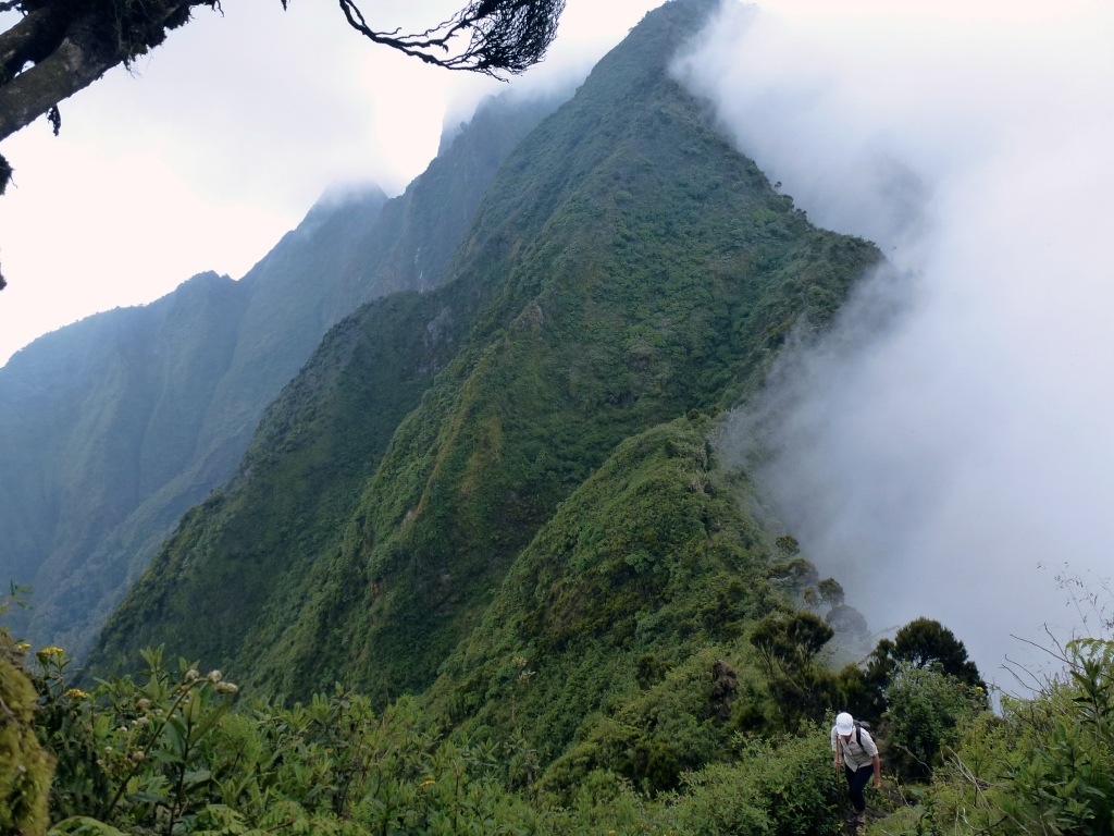
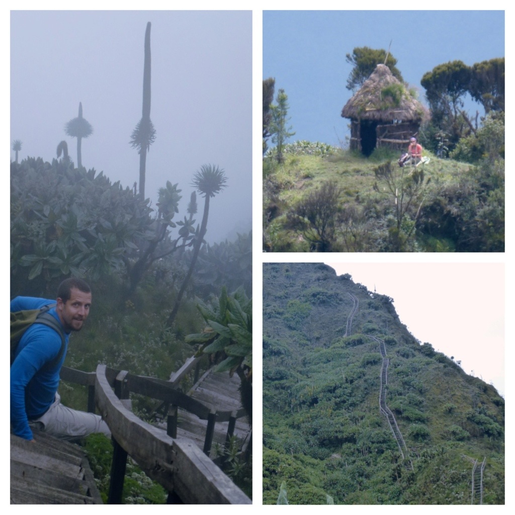
The lower part of the hike had some amazing dense bamboo forests. Once at the base of the volcano we were told things were about to get more difficult and we could see why. The trail now was going pretty much straight up, along a ridge that will take us to the first peak. It was about an hour and a half to the summit of the first peak and we probably gained 2,000 feet in elevation… At the top we could see the next two summits and could see the ladders that you had to climb to reach peak three (see pictures below). Along the way we had already used some of these ladders which were built out of sticks to help with steep sections. Peak 3 was pretty much all ladders since we had to go straight up to reach the top. This part was very scary for both of us. |
||||||||||

|
While we were never that high off the ground, the ladders were built on a very narrow ridge with 1,000 foot drop offs on either side. To make things worse a few of the ladder steps were loose and would move just a little bit. Very unnerving considering the height. We made it to the top of peak 3 with our guide Brian at around 11:50 pm. My mom stayed back at Peak 1, she was very tired and was not up for the ladders and wisely stayed back with Ellie. It was one of the scariest things we have ever done. |
|||||||||
|
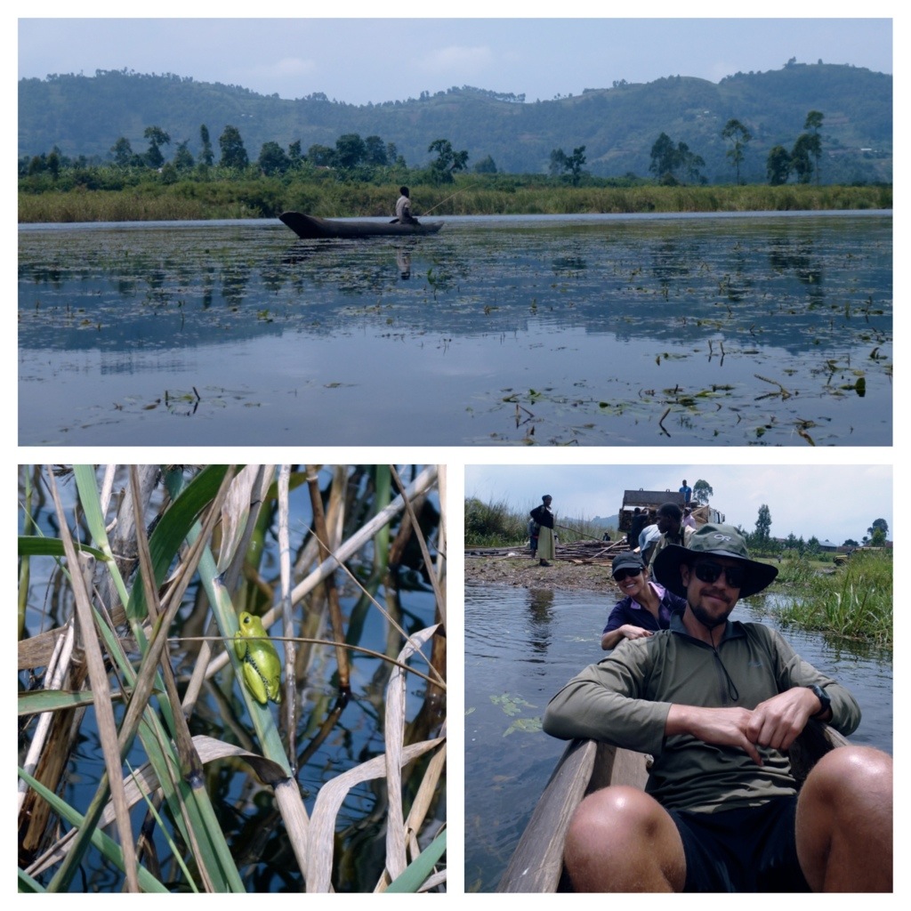
At the top, we made sure to spend some time in each country and even had lunch in the Congo (hey! Now we can say we have been to Rwanda and the DRC!). We had great views looking out towards Rwanda but clouds had rolled in blocking our views of the Congo. Brian thought it was best that we start the hike down given the cloud coverage and his prediction turned out to be true. For 2 hours, we were pummeled by one of the biggest downpours I have ever seen. Soon the trail turned into a river and every inch of us was soaked. We even had hail, painful enough that we had to keep any bare skin protected. Unfortunately, this slowed our pace down and we didn’t make it back to the car until 4:10 pm, 8.5 hours in total and soaking wet. Still, it was one of the most rewarding mountains we’ve climbed. It was physically demanding, 8.5 hours, 4,000 ft elevation gain, and submitted 5 peaks in total. As I said, climbing those ladders was one of the scariest things we’ve done but it was worth it to see the amazing views and check two more countries off the list. We also had a great time with our guides, Brian and Ellie. Two very nice guys which really made the trip more enjoyable. We had never been more excited for a warm shower and decided not to climb another volcano the next day. Especially with our plan to watch the Super Bowl at 2:30 am which is all I will say about the Super Bowl. The next day we were exhausted and enjoyed a lovely afternoon on the lake — where our guides were canoeing and we were relaxing! |
||||||||
|
We loved Kisoro – wonderful little town in Uganda. |
|||||||
|
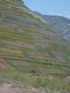
At this stage of our trip, 5AM wake up calls were becoming the norm. Today, after only two hours spent in the car, we arrived at Biwindi National Park for the gorilla trek. The drive to the visitor center was rough but took us through spectacular scenery (very similar to the road that took us to Kisoro); very steep drop offs, big mountains and lush green rainforest. It was amazing to see how much of the mountainside the locals are able to farm. Even on the steepest slopes, they have crops planted to the top. This area also gets very misty in the morning so we can see where the term “gorillas in the mist” came from. |
|
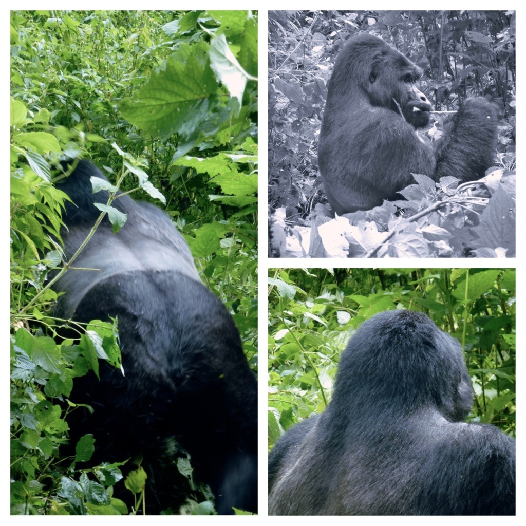
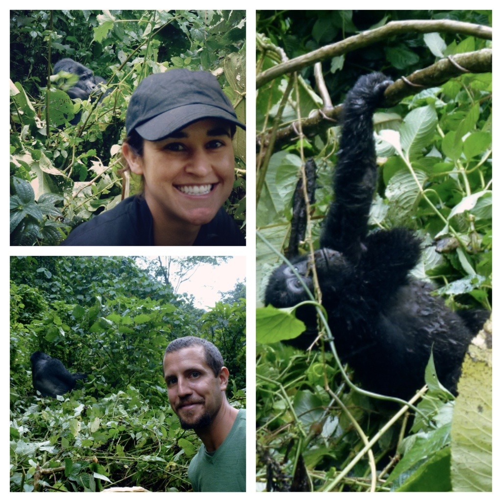
Neither of us really knew what to expect for the gorilla trek. All what we were told was (1) it could take up to 8 hours to find them and (2) to bring a rain jacket. I (Rob) thought we would be in a big group and only see them from a long distance, but what ended up happening was the 30+ trekkers were broken up into 4 groups. Each group had a guide and a security guard with an AK47. The reason for the gun was to protect us from other animals, including elephants and buffalo which are known to charge at times. Even the gorillas could be unpredictable. It turns out each group hikes to their own family of gorillas (which is about 10 gorillas per family and up to 20 gorillas). Each family has 2-3 people following them on a daily basis to ensure the trekkers are able to see them. |
|
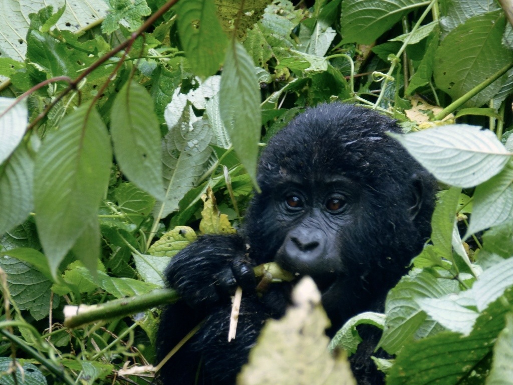
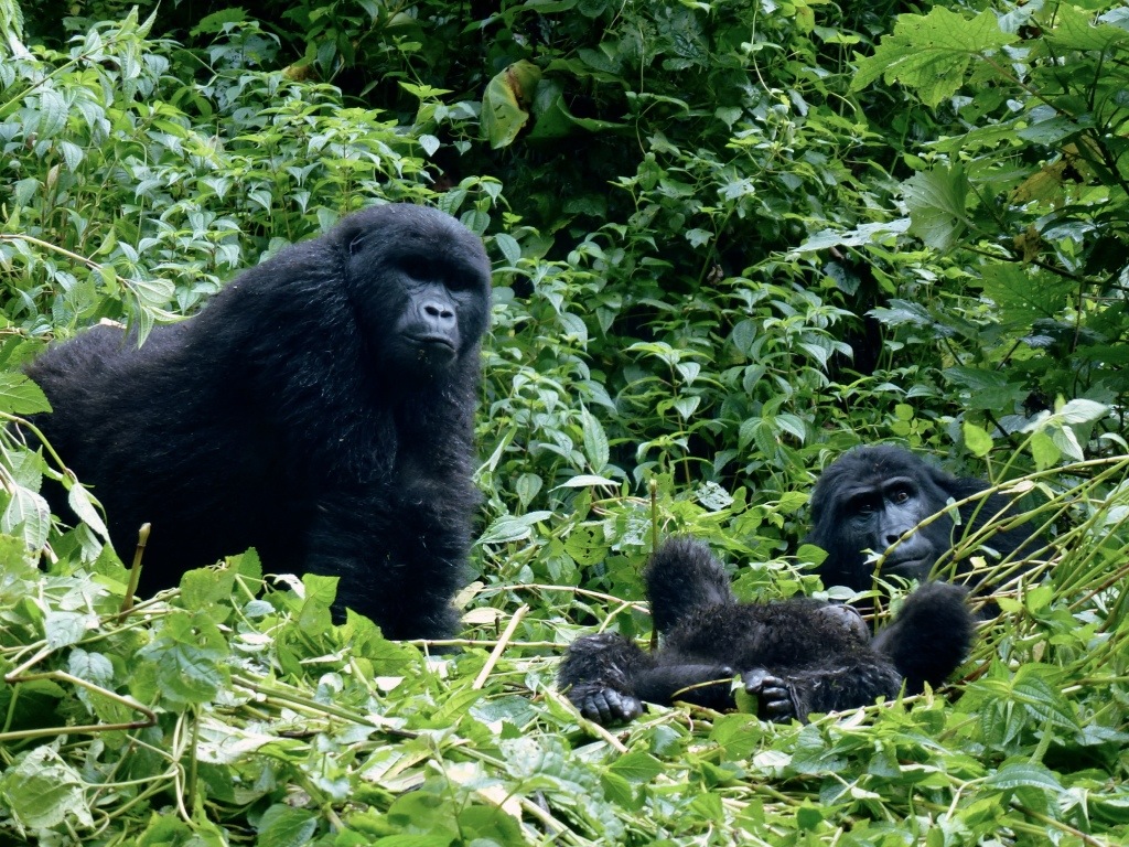
So our group of 10 (including 2 guides) set off to go find our family of gorillas (interestingly, we found out later how many locals know the gorilla families and asked us which family we were following). Most of the hike was along a pretty nice trail through the rainforest. After about an hour our guide received word of where exactly the gorilla were located. This meant bush-whacking time. Our guides used big knife to start blazing a trail through the rainforest towards the location of the gorillas as we slowly followed behind, slipping and sliding down a steep embankment. Twenty minutes later, we saw our first silver back (a.k.a. THE KING OF THE JUNGLE). I couldn’t believe how close we could get!! |
||||
|
We got some amazing pictures and had over an hour with the wild gorillas. Even better, our guides said we were lucky to have such good views and were able to get so close. An amazing experience to say the least. |
|
I found all this Gorilla information just fascinating. We learned a vast array of info from Gorilla Tours including: |
|
Male Gorillas: |

|
Female Gorillas: |
|
Lifestyle: |
